


The National Weather Service says the National Hurricane Center is monitoring two tropical waves for possible development over the next seven days.
It remains too early to know if either system will impact central North Carolina.
The National Oceanic and Atmospheric Administration said in the Central Caribbean Sea and Southwestern Atlantic a tropical wave is producing a large area of disorganized showers, thunderstorms, and gusty winds across portions of the Dominican Republic, and the Turks and Caicos islands.
An area of low pressure is expected to form along the wave tonight or early Friday when it moves near the southeast Bahamas. This low is expected to become a tropical depression when it is in the vicinity of the central and northwest Bahamas in a couple of days.
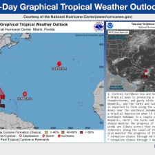
Interests in the Dominican Republic, Haiti, the Turks and Caicos Islands, and the Bahamas should monitor the progress of this system as heavy rains and gusty winds are likely across that region regardless of development.
Interests along the coast of the southeastern United States should also monitor the progress of this system.
The formation chance through the next 48 hours is high at around 70 percent and the formation chance through the next seven days remains high at 90 percent.
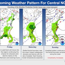
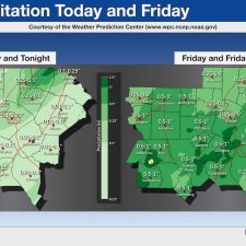
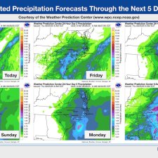
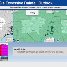
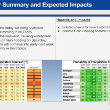
The NWS said in its late morning briefing that Friday a cold front will move into the region and continue the chance for showers and storms mainly in the afternoon and evening hours while on Saturday a stalled frontal boundary near the coast is expected to bring widespread showers and storms with the risk of isolated flash flooding. Cooler temperatures are expected.
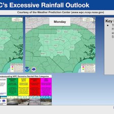
On Sunday an unsettled pattern continues as the frontal boundary remains along the coast.
Monday the coastal front has the potential for tropical interaction.


