

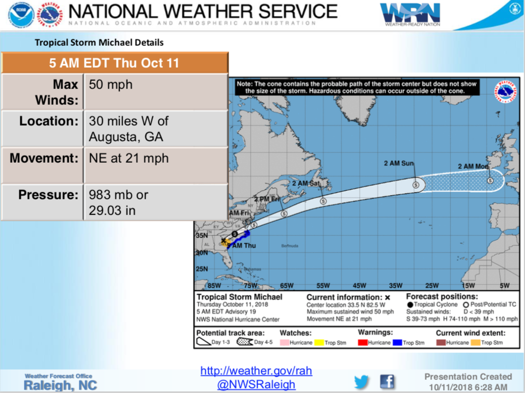
In its latest briefing this morning, the National Weather Service says Central North Carolina can expect elevated winds and the chance of flash flooding from Hurricane Michael.
The NWS expects the strongest winds from the storm to occur from the Triangle south and east with 20- to 30-mile per hour sustained winds and gusts of 30- to 40-miles per hour and occasional 50-mile per hour gusts which will result in downed trees.


Periods of heavy downpours could result in localized poor drainage or flash-flooding.
The NWS says isolated tornadoes can’t be ruled out with the greatest chance along a line from Charlotte to Raleigh to Roanoke Rapids.
Scattered power outages are expected.
The storm has already forced school closings and delays for today.


