

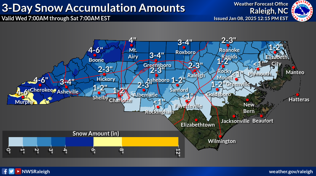
The Roanoke Rapids area could receive between 2 to 3 inches of snow coupled with an ice accumulation of between .01 to .1 inches, according to the Raleigh bureau of the National Weather Service.
During its noon briefing the NWS said confidence has increased that a winter storm will affect central North Carolina Friday into Saturday.
The storm is expected to bring a wintry mix and the potential for hazards.


All of central North Carolina will see light snow at the onset before changing to a wintry mix by late Friday evening.
While there remains uncertainty, a light glaze of up to a tenth of an inch is possible, most likely south of I-85. Scattered power outages will be possible where the heaviest ice accumulates, which is most probable near the North Carolina-South Carolina border.
Black ice is possible throughout central North Carolina Saturday night and potentially Sunday night.
The bureau said most of central North Carolina may experience travel hazards but as of this briefing it’s too soon to say how bad and where the worst conditions will be.


