

The National Weather Service said in its morning briefing it is closely monitoring the tropical disturbance over the northeast Caribbean as it could impact the southeast U.S. and Carolinas early next week.
The NWS said AL94 is a tropical wave located near Hispaniola and the Turks and Caicos islands this morning. It is expected to become a tropical depression when it is in the vicinity of the Bahamas later today or over the weekend. “While AL94 is expected to track to the northwest or north-northwest over the next few days, the exact track and intensity remain very uncertain.”
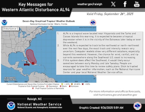
Computer models show very different solutions, especially beyond this weekend.
However, the chance for wind, rainfall, and rip currents somewhere along the Southeast U.S. coast is increasing.
If this system does affect the Southeast, it would likely occur sometime between early Monday and late Tuesday. “People are encouraged to take this time to review safety plans. Stick to trusted sources for your weather information, such as the National Hurricane Center and your local National Weather Service office.”
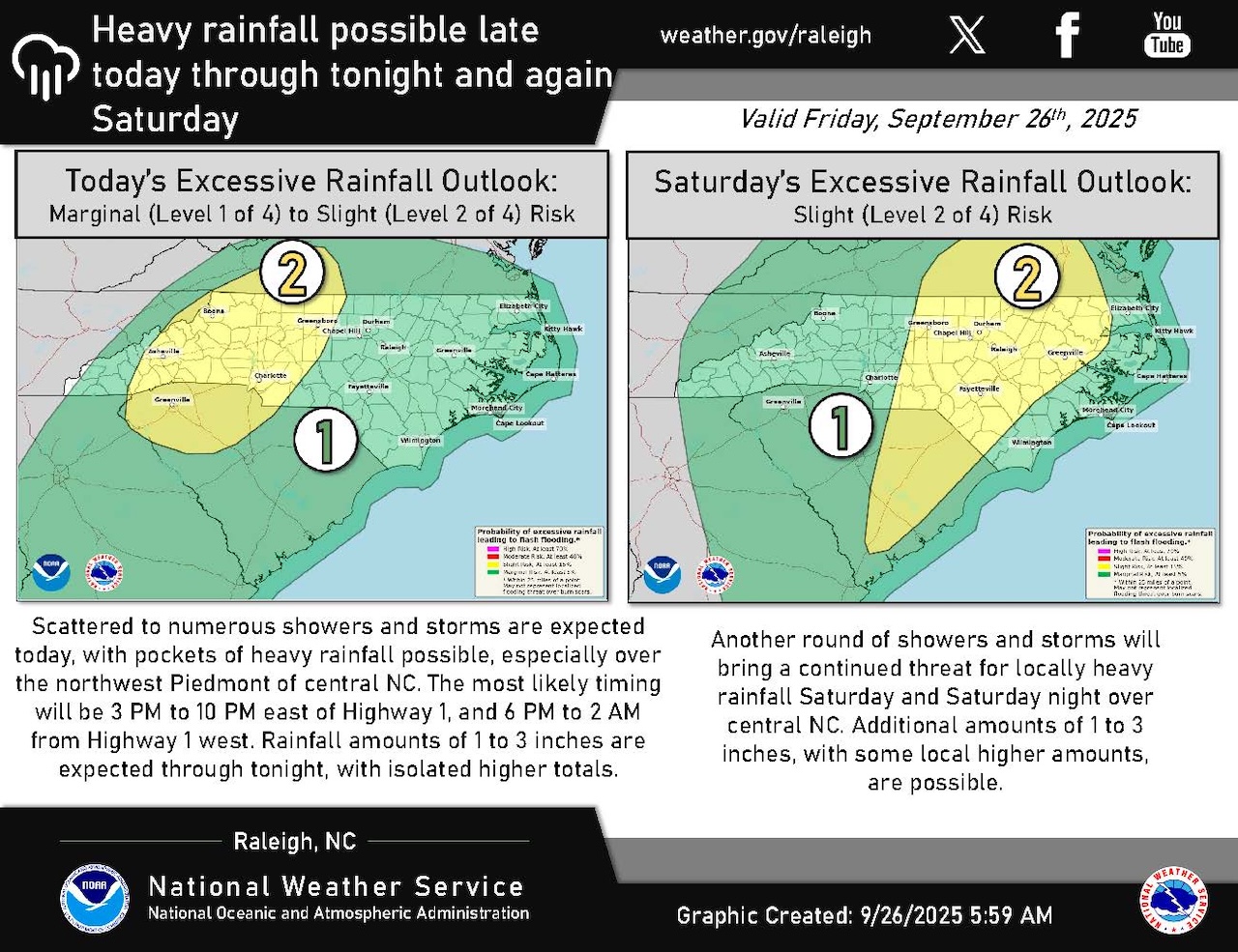
Meanwhile, Scattered to numerous showers and storms are expected today with pockets of heavy rainfall possible, especially over the Northwest Piedmont of central North Carolina.
The most likely timing will be 3 p.m. to 10 p.m. east of Highway 1, and 6 p.m. to 2 a.m. from Highway 1 west.
Rainfall amounts of 1 to 3 inches are expected through tonight, with isolated higher totals.
There is a slight risk of heavy rainfall, Level 2 of 4, over much of western North Carolina, including the Northwest Piedmont and Triad area today and tonight.
On Saturday, the slight risk of heavy rainfall covers all of central North Carolina.
Rainfall amounts of 1 to 3 inches are possible today and tonight and again on Saturday, with locally higher amounts.


