The expected inclement weather has already forced closure of Roanoke Rapids, Halifax County and Weldon City Schools for Wednesday as of this report. Gingerbread House preschool will also be closed Wednesday.
-
 Click to open image!
Click to open image!
Click to open image!
-
Click to open image!
Click to open image!
-
Click to open image!
Click to open image!
-
Click to open image!
Click to open image!
-
Click to open image!
Click to open image!
-
Click to open image!
Click to open image!
-
Click to open image!
Click to open image!
-
Click to open image!
Click to open image!
-
Click to open image!
Click to open image!
-
Click to open image!
Click to open image!
-
Click to open image!
Click to open image!


https://www.rrspin.com/archives/item/16143-advisory-upgraded-to-winter-storm-warning.html#sigProId7b6978359f
City Manager Joseph Scherer said at this evening’s council meeting, city administrative offices and facilities will be closed Wednesday. They will reopen on a two-hour delay Thursday.
In his report to council this evening, the city manager said, “We are again facing a winter storm that will test our departments to respond effectively to provide for our citizen’s safety, which I know they will do with pride.”
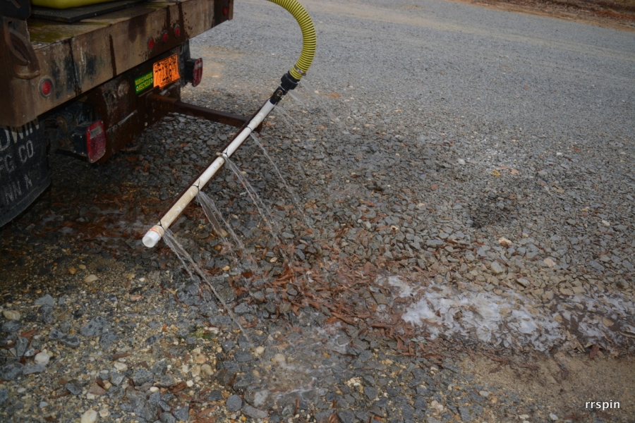
Public Works Director Larry Chalker told council the department started brine production this morning and will continue applying the mixture to city streets throughout the evening. “All 93 miles will be covered with salt brine. It helps us to better remove any accumulating snow from the streets.”
The city is currently on its second supply of salt, which equates to an amount which fills two tractor-trailer size dump truck loads.
The city, Chalker said, continues to perfect its brine-making process and this year was able to produce 16 percent more brine while using 19 percent less salt. “Knowing that it’s $10,000 per order, that’s real dollars in savings.”
Chalker said current predictions are for 3 to 4 inches of snow to fall, but added, “We could see as high as 4 to 7. They’ve been talking an increased threat. In our area it’s difficult to get an accurate forecast. We’re planning for the worst, but hoping for the best.”
Chalker’s comments to council essentially fall in line with the NWS forecast, which says 2 to 4 inches of snow is possible through Wednesday afternoon and evening with locally higher amounts beginning in the early morning hours Wednesday.